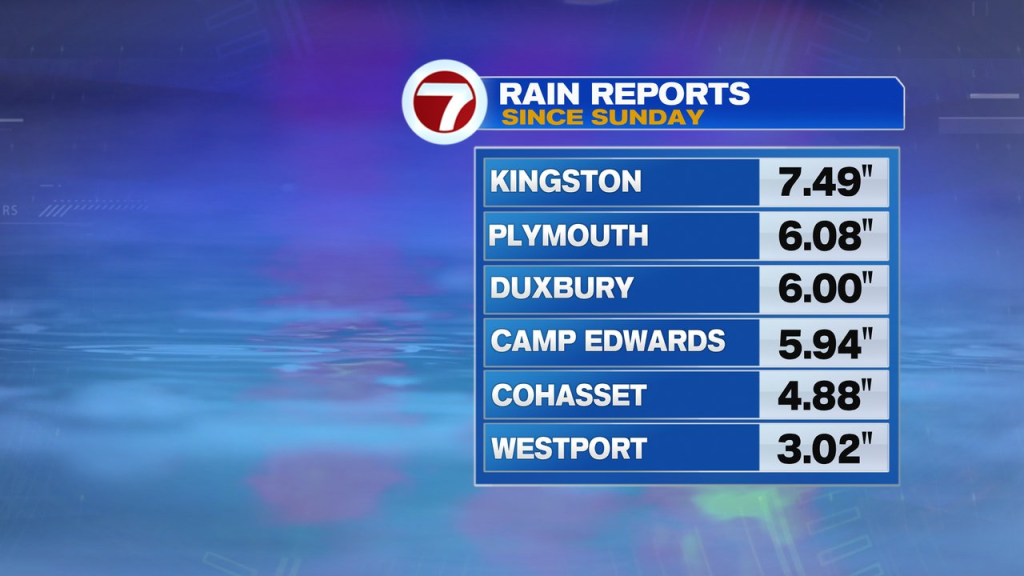
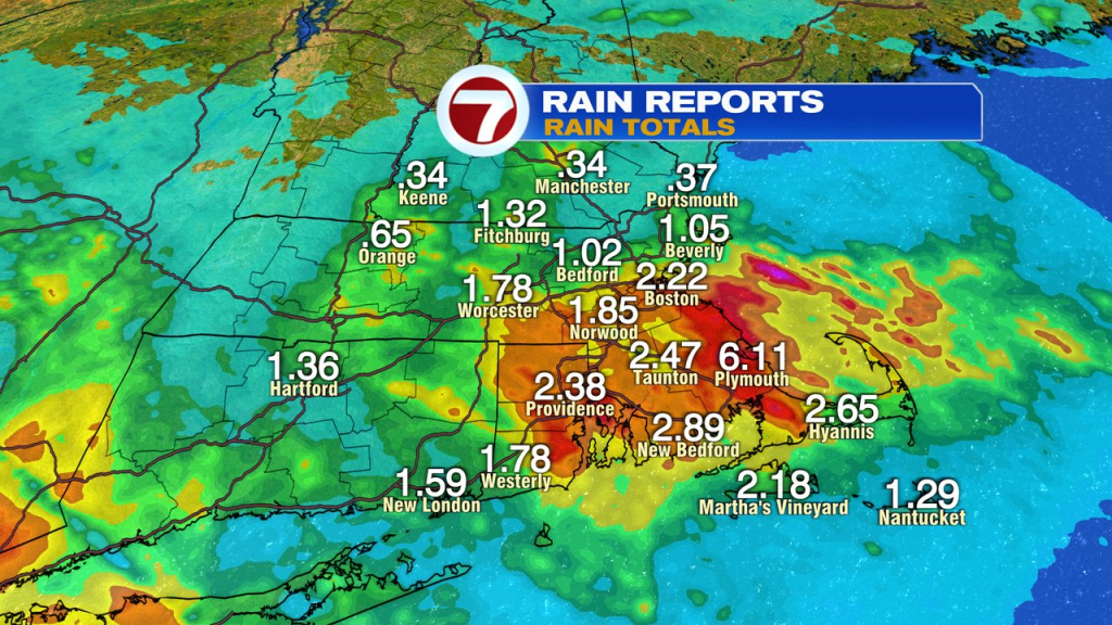
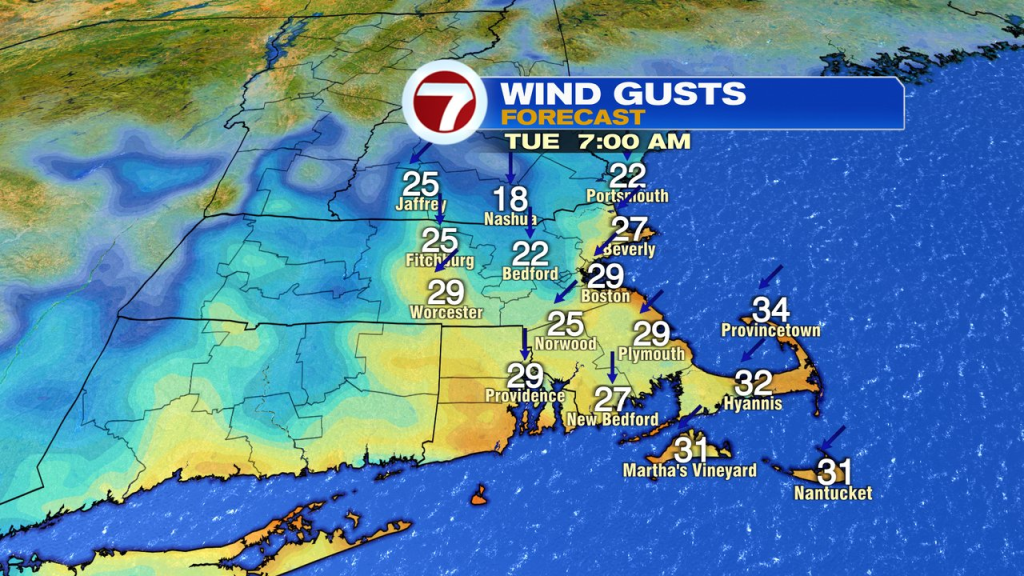
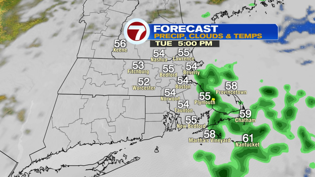
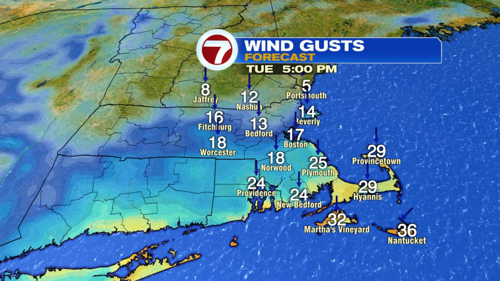
The nor’easter that moved in Sunday, is slow to move out on this Tuesday. While the wind and rain won’t be as much as it was yesterday, we’re still dealing with gusty breezes and wet weather through this Tuesday morning. The heaviest rain is near the coast, especially in Southeast Mass, where the highest totals have added up. Across eastern Plymouth County and the western part of the Cape, rain totals have added up to 4-7″ of rain! For most locations near and north and west of Boston, the totals have generally been in the 1-3″ range. Winds gusted 45-55mph yesterday, but back to 25-35mph this morning.

Showers taper off by midday inland today, but hold near the coast into the afternoon, with some showers lingering into this evening across the Cape. Overnight, all of us dry out as winds turn to the northwest.
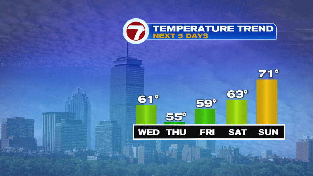
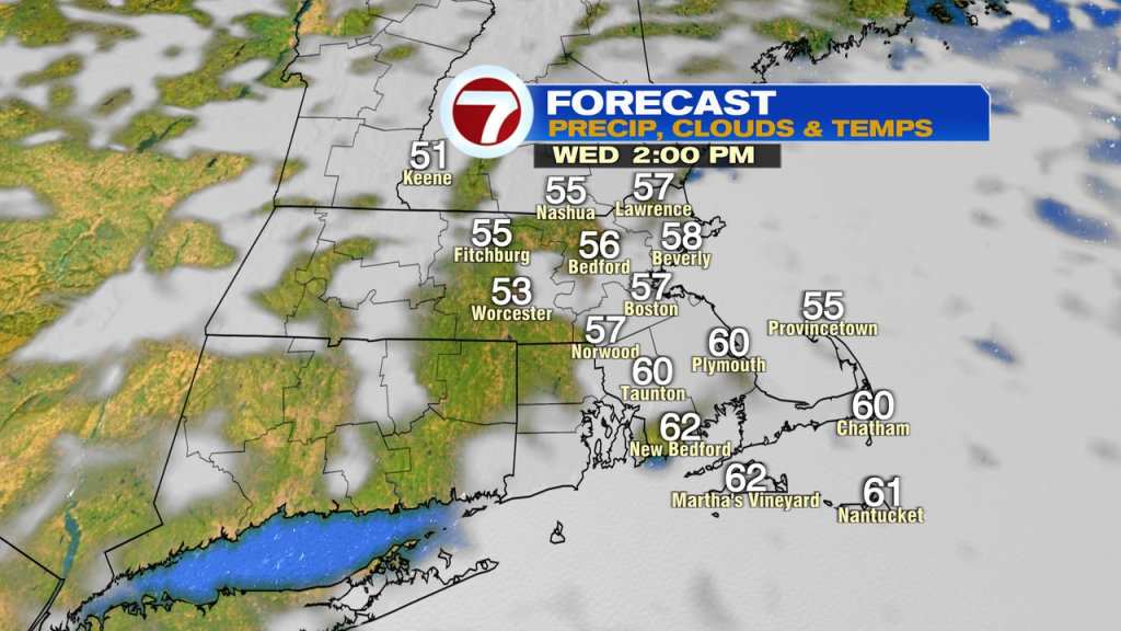
A mix of sun and clouds are back tomorrow with highs near 60.
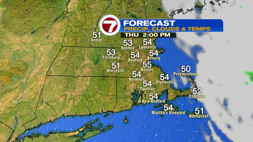
Thursday is cooler, mid 50s with a ton of sun away from the Cape and Islands. Across the Cape and Islands, a few spotty ocean-effect sprinkles/showers are possible too.
The overall drier pattern lingers into the weekend. We’ll warm up too with highs back to the low 70s by Sunday.